|
Geographic
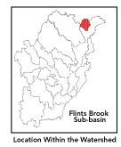
Overview and Ecosystem Characteristics: This
subbasin1
completely lies in the community of Hollis, New Hampshire.
Located in the Southern New England Coastal Plains and
Hills ecoregion of southcentral New Hampshire, Flints
Brook flows into the Nashua River downstream of Runnels
Bridge by Route 111. Streamflow, as in most of New England,
has significant seasonal changes. Pine Hill is the
high elevation in the subbasin. Route 130 passes through
this subbasin. Open rolling scenery with orchards and
farms characterizes the subbasin.
back
to top
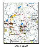
Land Ownership
and Land Use4
Patterns: Tremendous development
pressure in southcentral New Hampshire. According to
a recent report, New Hampshire's Changing Landscape
by the Society for the Protection of New Hampshire Forests
(2001), growth projections in Hollis are astronomical:
an approximate 76% increase.
The land-use pattern is largely forest
(68%) or wetland. Low-density residential settlement
as well as concentrated settlements and strip development
located near town centers and along major roads account
for rapidly increasing residential use. A relatively
high percentage of total land area is agriculture and/or
open space. Yet increasing amounts of total impervious
surfaces — namely, paved areas such as streets,
driveways, and parking lots — for this subbasin
indicates that issues of compromised stormwater and
other non-point sources of contaminants (for example:
pesticides, fertilizers, oils, asphalt, pet wastes,
salt, sediment, litter and other debris) are a growing
concern.
back
to top
Major
Water Resource Issues:
Flints Brook, whose origin is in Flints Pond, is classified
as a cold-water stream supporting native brook trout.
Flints Pond is fed by Parker Pond and Muddy Brooks and
is bordered by extensive wetlands both upstream and
downstream of the pond. There are milfoil problems in
Flints Pond, which had been considered for dredging
by the US Army Corps of Engineers project. Polluted
runoff and sedimentation is an increasingly serious
issue in rapidly developing communities.
back
to top
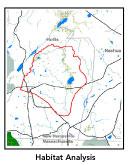
Recreation
and Priority Habitat Areas: Spalding
Park Town Forest, Brookdale Fruit Farm, and Flints Brook
greenway are the largest blocks of protected open space
in this subbasin.
back
to top
Resource
Protection Goals and Recommended Actions
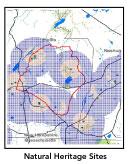
GOAL: Protect wildlife
habitat and migration corridors in the subbasin.
- Encourage protection of Parker Pond
bog area in Hollis, NH.
- Sponsor local events to raise public
understanding about native wildlife and the impacts
of development patterns on ecosystem and habitat integrity.
- Work with local conservation commissions
to gain their backing of natural resource and habitat
inventories.
GOAL: Protect high-priority open space,
vistas, and community character in the subbasin.
- Work toward ideal of at least 25-50%
protected open space in each municipality.
- Work with municipal officials to develop
subdivision standards that require proponents to devote
at least 50% of land (not including already undevelopable
wet or steep land) for open space conservation and
encourage mixed-use development and cluster zoning
by-right bylaws.
- In New Hampshire, 5% stumpage tax from
forestry activities and fines for removal of a property
from current use for development should be directed
into a municipalities' dedicated conservation fund
rather than the general fund.
GOAL: Increase recreational opportunities
throughout the subbasin.
- Survey invasive plant infestation and
conduct spot treatment to control spread of noxious
plants at Flints Pond.
- Educate the public and municipal departments
(especially DPWs) on efforts relating to invasive
species identification and removal.
GOAL: Improve water quality in the
subbasin.
- Help develop and disseminate Best Management
Practices (BMPs) for small-scale, hobby type agricultural
operations.
- Identify underground storage tanks
(USTs) and work to have them removed.
GOAL: Reduce potential negative effects
of some development in this subbasin.
- Monitor development along the banks
of Flints Brook to ensure building practices are sensitive
to riparian habitat and water quality considerations.
- Help local volunteer board members
responsible for development and land-use rulemaking
and enforcement get technical assistance and information
regarding techniques to control/guide land use and
development balanced with adequate resource protection.
- Increase or establish staff hours
for municipal conservation agents to more effectively
monitor construction sites runoff and assist with
the preparation of bylaws such as erosion-sedimentation
controls.
back
to top
*
|