|
Geographic
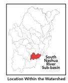
Overview and Ecosystem Characteristics: This
subbasin1
lies in the communities of Clinton, Lancaster and Sterling with
a very small part extending into Bolton. Located in the Southern
New England Coastal Plains and Hills ecoregion2
of central Massachusetts, the South Nashua River flows into the
North Nashua River at "Meeting of the Rivers" in Lancaster
from which point it is called the Mainstem Nashua River. The South
Nashua River officially begins at the outfall of Wachusett Reservoir
dam (which is the source of Lancaster Millpond). It flows north
through the towns of Clinton and Lancaster. Routes 62 and 110 travel
through this subbasin. Several freight train lines cross this subbasin.
Streamflow, as in most of New England,
has significant seasonal changes3.
It is interesting to note that this subbasin is unusual in having
once been the site of a glacial lake (Lake Nashua) that flowed southward
toward the Worcester area. At the end of the last Ice Age, its direction
reversed, creating the Nashua River as we know it today. The South
Nashua (and the Mainstem) River now flows northward from its impoundment
at Wachusett Reservoir in contrast to all of the river's major tributaries,
which flow in a southeasterly direction.
A very small portion of the Central Nashua River
Valley Area of Critical Environmental Concern4
(ACEC) — currently the only ACEC in the Nashua River watershed
—- falls within the northern section of this subbasin in the
Five Corners neighborhood of South Lancaster.
back to top
Land Ownership and
Land Use5
Patterns: The land-use pattern is 67%
forest (hardwood mixed with softwood) or wetland. Low-density residential
settlement as well as concentrated settlements and strip development
located near town centers and along major roads account for a total
of 11% residential. Approximately 8% of total land area is agriculture
and/or open land. Although these land-use estimates do not suggest
a high risk for potentially contaminated runoff, the land-use along
the South Nashua River in Clinton is primarily high density residential,
industrial, and commercial. Such land use types have a much greater
potential to negatively impact water quality due to urban runoff/storm
sewers.
Indeed, 17% of this subbasin is total impervious
surfaces6
—- namely, paved areas such as streets, driveways, and parking
lots —- which indicates that issues of compromised stormwater
and other non-point sources of contaminants (for example: pesticides,
fertilizers, oils, asphalt, pet wastes, salt, sediment, litter and
other debris) are a pressing concern. Primary pollutants of concern
in stormwater are suspended solids, nutrients, metals, oil and grease,
temperature and bacteria. The sources of bacteria in urban settings
—- typically human litter and animal waste —- originate
on driveways, lawns, commercial and residential streets, parking
lots and rooftops. Furthermore, increasing urbanization leads to
diminished groundwater recharge and to declining stream flow as
well as stream channel widening and downcutting.
A shoreline survey of the South Nashua River
within Clinton was conducted by the Clinton Stream Team in fall
of 1999. Although several problems were noted —- including
evidence of urban run-off, erosion (dirt bikes), severe sediment
deposition, storm drains, trash and considerable debris —-
the river was generally described as having a good buffer and was
"aesthetically pleasing" in its upper reaches.
back to
top
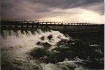
Major Water Resource
Issues: The South Nashua River is considered
a warm water fishery. The flow of the South Nashua River is regulated
by the operations of the Metropolitan District Commission dam at
Wachusett Reservoir where hypolimnetic (very deep and cold, nutrient
poor) water is released at a minimum rate of only 2.6 cubic feet
per second. This small amount7
is perhaps not adequate to maintain natural flow regimes.
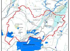
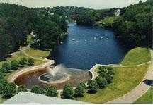
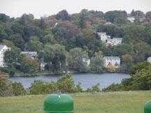
Major waterbodies in this subbasin are: in Sterling,
East Waushacum Lake and Fitch Pond; in Clinton, Lancaster Millpond
and the complex of Coachlace, Mossy, East South Meadow, and West
South Meadow Lakes. South Meadow Ponds are classified as eutrophic
and as having noxious plants and high turbidity. There is a large
wetland at the inlet of Fitch Pond, which is hydrologically connected
to the South Meadow Lakes complex via South Meadow Brook. Goodrich
Brook is a feeder stream to the South Nashua entering that river
upstream of the Clinton Wastewater Treatment Facility (WWTF). The
only other contributing waterway is Counterpane Brook, which is
underground in sections and otherwise channelized where it sees
daylight.
The one major municipal effluent NPDES*
permit in the subbasin is for the Clinton WWTF8
. Four additional NPDES minor industrial discharge permitees are:
The Kelly Co., Inc. (discharging to Counterpane brook); Rockbestos
Surprenant and Cable Co. (discharging to Rigby Brook); and Cumberland
Farms/Gulf Gas and Weetabix Co.9
(both discharging to the South Nashua River). There are no registered
water withdrawals permits.
The Nashua River Watershed Association (NRWA)
collected fecal coliform bacteria samples in 1996 and 1997 in the
South Nashua River. NRWA's data indicated elevated levels of fecal
coliform bacteria during wet and dry weather conditions as did state
Division of Watershed Management (DWM) water quality testing data.
Based on the elevated fecal coliform bacteria counts, detection
of unknown toxicity and best professional judgment, the indicator
"Primary Contact Recreational Use" in the 1.6 mile reach
of the South Nashua River downstream from the Clinton WWTF discharge
is assessed as non-supporting; everywhere else recreational uses
were assessed as partially supporting. "Secondary Contact Recreational
Use" is assessed as partial support.
The state DWM water quality testing determined
that there was moderate impairment to the benthic macroinvertebrate
community as well as effluent toxicity, low dissolved oxygen, and
high phosphorus, and thus assessed the indicator "Aquatic Life
Use" as non-supporting. Further, elevated levels of phosphorus
were detected in the Clinton WWTF effluent by the Environmental
Protection Agency (EPA). Indeed, the sampling station located downstream
of the Clinton WWTF had both the highest total phosphorus (TP) and
ammonia-nitrogen concentrations of those surveyed in 1998 by DWM
in the entire Nashua River Basin.
back to
top
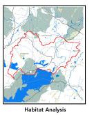
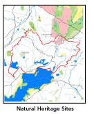
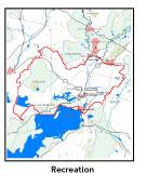
Recreation and
Priority Habitat Areas: Other than several
town parks and recreation areas in Clinton, there is relatively
little permanently protected open space in this subbasin other than
Metropolitan District Commission lands immediately around Wachusett
Reservoir. One other significant state holding is MassWildlife's
Clinton Bluffs along the banks of the South Nashua River, which
is also this subbasin's one state-designated Natural Heritage and
Endangered Species Project (MA NHESP) Priority Habitat Area. This
area is also designated a BioMap10
core area (as are two other small areas in Lancaster). There are
no MA NHESP Rare Wetlands Wildlife sites within this subbasin. One
habitat protection focus area identified in the Nashua River
Habitat Assessment Report (MAS, 2000) is Wachusett Reservoir,
which encompasses the South Meadow Ponds complex north of the reservoir.
As a result, habitat conservation priorities should include protection
of the South Meadow Brook area.
back to
top
Resource Protection
Goals and Recommended Actions
GOAL: Protect wildlife habitat
and migration corridors in the subbasin.
- Land protection efforts to focus undeveloped lands
in South Nashua River floodplain (notably opposite Clinton WWTF
and opposite Savage Field).
- Sponsor local events to raise public understanding
about native wildlife and the impacts of development patterns
on ecosystem and habitat integrity.
- Work with local conservation commissions to gain
their backing of natural resource and habitat inventories.
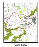
GOAL: Protect high-priority open space, vistas,
and community character in the subbasin.
- Protect view from Woodruff Road overlooking river.
- Encourage the use of MA Executive Order 418*
funding for Open Space and Resource Protection Plans for each
Massachusetts community in this subbasin.
- Conduct public education sessions to promote local
passage of Community Preservation Act*.
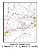
- Work toward ideal of at least 25-50% protected
open space in each municipality. Determine which Chapter 61, 61A
and 61B properties to pursue Right of First Refusal*
options on if the opportunity arises.
- Work with municipal officials to develop subdivision
standards that require proponents to devote at least 50% of land
(not including already undevelopable wet or steep land) for open
space conservation and encourage mixed-use development and cluster
zoning by-right bylaws.
GOAL: Increase recreational opportunities throughout
the subbasin.
- Re-examine the feasibility of developing a multi-purpose
trail along the railroad spur that extends from Water Street to
the Hopfman property and Clinton Prairie Bluff area.
- Organize and conduct "clean-up" effort
of illegal dump site by Fuller Field on slope to Counterpane Brook
as well as of the entire South Nashua River utilizing, in part,
local citizen monitoring groups.
- Support the South Meadow Pond and Nature Association
in its environmental remediation efforts as well as survey and
control invasive plant infestation (spread of noxious aquatics)
in South Meadow Ponds.
- Consider reclassifying the upper reach of the river
to Wachusett Dam as a Cold Water Fishery given that it receives
hypolimnetic release from Wachusett Reservoir during the critical
summer months.
- Educate the public and municipal departments (especially
Public Works Depts) on efforts relating to invasive species identification
and removal.
GOAL: Improve water quality in the subbasin.
- Identify sources of fecal coliform and other contaminants.
- Evaluate the current minimum release from MDC at
the Wachusett Reservoir dam. To the extent possible, maximize
flow from Wachusett Dam to maintain natural flow regimes.
- Determine locations of combined sewer overflows
(CSOs) in Clinton. Continue to track progress of CSO abatement
activities. Conduct additional dry and wet weather fecal coliform
bacteria monitoring in most impacted segments of South Nashua
River to identify potential sources of pathogens and other contaminants.
- Identify and rectify problems with factory floor
drains that may still discharge pollutants to waterways (versus
to discharging to tight tanks or sewer systems).
- Evaluate the need for stormwater controls (i.e.,
permits, pollution prevention plans, best management practices
BMPs) in the industrial and commercial developments. Inventory,
monitor and improve stormwater drainage structures.
- Implement recommended BMPs from TMDL-urban runoff.
- Identify any other WMA withdrawals in the subwatershed
of this segment of the Nashua River. Evaluate any potential impacts
of WMA withdrawals on streamflow/habitat.
- If the Clinton Wastewater Treatment Facility continues
to have problems meeting its whole effluent CNOEC (chronic no
observed effect concentration) limit, a toxicity identification
and reduction evaluation (TIE/TRE)*
should be conducted.
- Continue to monitor nutrient concentrations in
most impacted segments of the South Nashua River and evaluate
the NPDES facilities —- in particular the Clinton WWTF —-
compliance with their effluent total phosphorous (TP)*
limits.
- Determine and rectify causes of sediment deposition.
- Identify underground storage tanks (USTs) and work
to have them removed.
GOAL: Reduce potential negative effects of some
development in this subbasin.
- Reduce total impervious cover to below 15% threshold.
- Help local volunteer board members responsible
for development and land-use rulemaking and enforcement get technical
assistance and information regarding techniques to control/guide
land use and development balanced with adequate resource protection
(e.g., Citizens Planner Training Collaborative11
workshop offerings).
- Increase or establish staff hours for municipal
conservation agents to more effectively monitor construction sites
runoff and assist with the preparation of bylaws such as erosion-sedimentation
controls.
back
to top
|