Riparian Restoration
Whitney Pond Dam Removal & River Restoration Project: Ashburnham
Ongoing Updates on Whitney Pond Dam Removal and Whitman River Restoration Project
UPDATE July 14, 2026: Project partners, state and municipal officials, and community members gathered at the new Whitney Pond Dam Conservation Area in Ashburnham for a ribbon-cutting ceremony to celebrate the removal of the dam and the restoration of free flow to the Whitman River, a multi-year project. We were honored to have Rebecca Tepper, Secretary of the Executive Office of Energy and Environmental Affairs, and Beth Lambert, Director of the Division of Ecological Restoration, share remarks, alongside members of the project team. View a brief video, “Years of Planning. One River Restored.” (0:34 min), an overview of the importance of this project. The video is accompanied by comments from Jessica Veysey Powell, NRWA Water Programs Director, who served as the NRWA lead on this project.

_________________________________
UPDATE June 18, 2026: Last summer the Town of Ashburnham, with the support of multiple local, state and nonprofit partners removed the Whitney Pond Dam, allowing this section of the Whitman River, a coldwater fishery resource, to run free. The project has already provided aquatic habitat, water quality and climate resilience benefits to the wildlife and community of Ashburnham. Educational signage, trails and benches at the site have created a new Whitney Pond Dam Conservation Area, where the public can learn about the rich history of the former mill and watch the ecosystem recover in the years to come.
Please join us to celebrate the successful completion of this project!
- When: 10 am on July 14, 2026, rain date is July 15 at 10 am
- Where: The new Whitney Pond Dam Conservation Area
- Parking: Please park in the large dirt parking area next to the Alltown located at 6 Gardner Rd, Ashburnham, MA
- What to expect: Remarks from some of the project partners and funders, a ribbon cutting and an opportunity to tour the site and learn more about the project. This event is outdoors; appropriate footwear is recommended.
- RSVP: Please RSVP by replying to this email or sending an email to Susie.bresney@mass.gov.

_________________________________
UPDATE June 2026: Project partners are planning a ribbon-cutting event to be held at the site on Tuesday, July 14 at 10:00 am. There is a rain date of Wednesday, July 14 at 10:00 am. More details to come.
_________________________________
UPDATE June- first week: The construction partner, Lucianos, completed the final plantings at the site.

Photo (taken in April): Restoration plantings at the site included carefully selected native wetland and riparian (streamside) grasses, shrubs, and trees. The mound in the background to the right is a remnant of the old dam wall. Photo courtesy of Pare Corporation.
_________________________________
UPDATE May 19, 2026: Led by the project engineering partner, Pare Corporation, the NRWA and the MA Division of Ecological Restoration (DER), completed the first round of vegetative-plot analysis and photo documentation of the post-removal habitat restoration process. This monitoring is required by the project permits.
Both the vegetation transects and the photo stations sites were selected to record changes to different parts of the site. The three vegetation transects are in: the upper impoundment, the lower impoundment, and just downstream from the former dam site. The seven photo plots are located as follows: four focused on the upper impoundment, one on the wetland just upstream of the former impoundment, one capturing the lower impoundment and dam site, and one capturing the dam site from downstream of the dam. The project team will continue to monitor how the site evolves at these stations for five years. Any invasive plant species observed will be removed.


Photo 1: Project team looking at vegetation plot. Photo 2: View of Whitman River running through lower impoundment, remnants of the dam are at the left mid-picture. Restoration plantings can be seen on both sides of the river.


Photo 3: View from the upper impoundment looking downstream to the railroad bridge. Photo 4: Looking westward across the upper impoundment, the river flowing right to left in this image.
_________________________________
UPDATE April 22, 2026: The “as-built survey” of the site was completed. This survey is conducted after construction is complete to document the actual, physical dimensions of structures, the stream channel, etc. Revisions and adjustments often have to be made during construction making the final site slightly different from the original plans. The as-built survey is required as a permit condition. The contractor’s surveyor completed three cross-sectional surveys of the river channel, and one longitudinal transect parallel to the stream. This information will help the partners monitor channel formation going forward. View Final As-Built Survey- Whitney Pond Dam Project.pdf.
_________________________________
UPDATE April 16, 2026: The project construction partner installed a trailhead sign and two interpretive signs on the new walking trail. One interpretive sign provides visitors with information on the history of the site, and the other gives an overview of the dam removal and ecological restoration process at the site. The walking trail is now open for public use.


Photo 1: Installing interpretive signs on walking trail. Photo 2: Benches and signs along walking trail. Photos courtesy of Pare Corporation.


Photo 3: Walking trail entry sign. Photo 4: Interpretive sign about the history of the site. Photo 5: Interpretive sign about the dam removal and ecological restoration project at this site.
_________________________________
UPDATE April 14 and 15, 2026: Spring fish-community eDNA sampling was also completed. eDNA sampling is used to identify what fish species are likely present in the stream. This represents the first spring sampling post-removal of the dam. Fish eDNA will be sampled again in October.


_________________________________
UPDATE April 7, 2026: NRWA reinstalled dissolved oxygen (DO)/temperature loggers to track these two indicators that are important to water quality and aquatic habitat. NRWA’s loggers will remain in the water throughout the growing season (until mid-November).


Photo 1: Logger installed in stream. Photo 2: Reading logger data.
_________________________________
UPDATE February 26, 2026: The NRWA visited John R. Briggs Elementary School to lead a lesson on Climate Change and Flooding for all four 5th grade classes, reaching 80 students. The lesson developed by NRWA supported the MA STE Standards 5-ESS3-1 which states: “Obtain and combine information about ways communities reduce human impact on the Earth’s resources and environment by changing an agricultural, industrial, or community practice or process.”
View the NRWA original video, “Whitman River Restoration Project”, that was created for and shared with students as part of this lesson. (5:39 min.)
Along with learning about the dam removal and restoration process being undertaken at Whitney Pond in their own community, students used interactive water models – building materials, water, and a variety of sediments, including sand, pebbles, and small rocks – to observe the effects of excessive rain and other precipitation on land and other processes such as erosion. Students went on to develop and test a series of engineering designs using various pervious and impervious building materials to determine best practices for directing water in a safe and environmentally sound manner. They were introduced to the term “Nature-based Solutions” (NBS) as they looked for effective ways to mitigate flooding issues for human infrastructure, while keeping vital resources like freshwater ecosystems healthy and functional.


_________________________________
UPDATE December 4, 2025: The restoration team carefully selected native wetland and riparian (streamside) grasses, shrubs, and trees for planting throughout the dam removal and restoration area. These plantings will help to stabilize and prevent erosion of the banks and impoundment areas. As these new plantings grow and spread, they will create healthy habitat for native species of insects, birds, and mammals. The seeding and planting work was completed in November. Work on the walking trail is also nearing completion with a fence and benches installed. The delivery of interpretive signs is anticipated by mid-December. The active construction phase of this project is complete.


Photo 1 Whitman River looking upstream toward what was the lower impoundment (former dam pond). The fencing mid-photo at the left marks the site and elevation of the old dam wall.
Photo 2 The line of stakes in this photo is a row of “live stakes” planted by the restoration team on the banks of the river. Live stakes are cuttings from woody plants (like willow) that are alive but dormant. They will develop their own roots, forming a strong network to stabilize the soil and prevent erosion.


Photo 3 Whitman River looking upstream through the restored lower impoundment (former pond) with the railroad bridge in the distance.
Photo 4 The upper impoundment area looking downstream across the wetlands and restored river toward the railroad bridge.
_________________________________
UPDATE October 2025: Revegetation of the entire project area can be seen from the upper impoundment, down through the lower impoundment, and on downstream of the old dam wall. View NRWA video showing the presence of fish at the site (species not identified). NRWA is conducting eDNA sampling to identify what fish species are likely present in the stream. eDNA may also identify a wide variety of non-target species, including salamanders, birds, and mammals. Restoration planting of native trees and shrubs remains to be completed in November.


Photo 1- upper impoundment Photo 2- lower impoundment Photo 3- downstream of former wall
_________________________________
UPDATE August 28, 2025: The NRWA first installed data loggers in 2023 to study stream temperatures and oxygen levels prior to the start of construction work, and we will also monitor this data once construction is complete enough to allow. Fortunately, dam removal ended just in time to reinstall the loggers in late summer, right before the brook trout fall-spawning season. Brook trout are a coldwater species, sensitive to temperature and oxygen levels.


Photo 1: Jessica Veysey Powell of NRWA installs a logger in Whitney Pond to gather data on temperature and oxygen levels in dam impoundment prior to the start of the project. Photo 2: Utkir Adkhamov of NRWA works on downloading logger data.
_________________________________
UPDATE August 13, 2025: Work on dismantling the dam wall is complete. Small portions of the dam wall will remain on either side of the stream as part of a naturalized landscape.
Work on the sediment cell has also been completed. The public walking trail on top of the capped cell is complete. Two historic outlet gate headworks, which were previously part of the working dam, have been preserved and will be exhibited along the walking trail.


Photo 1: New public walking path on the west side of the Whitman River. Photo 2: Outlet gate headworks preserved during the dam wall deconstruction. The chair factory that once existed at this site (below the dam) was powered by water, and this mechanism was used to control the flow of water by raising and lowering gates in the dam wall.
ALSO, the river channel through the lower impoundment has been defined, and channel stabilization and erosion controls have been installed. Riffles have been created in the stream channel using stones from the dam. Riffles help oxygenate the stream as the water tumbles over the rocks, create habitat for aquatic species, and reduce erosion of streambanks. Plant life is already beginning to return to the lower impoundment area. Visitors are aware of bird activity, as birds are drawn to the newly disturbed area which tends to provide increased opportunities to find food. Animal tracks can be seen in the mud near the stream channel.


Photo 1 and 2: Channel definition and stabilization in the lower impoundment area. Photo 3: Stones in the channel create riffles to improve water quality and aquatic habitat. Photo 4: Unidentified animal tracks in mud next to the river channel.
_________________________________
UPDATE July 16, 2025: Meet part of the Whitney Pond Dam Removal and Whitman River Restoration team!

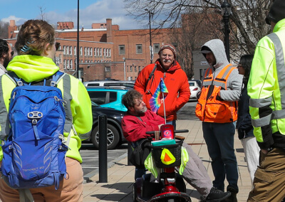
Photo of team members, left to right: Jessica Veysey Powell, NRWA Water Programs Director; Alex Ribeiro, Lucianos Excavation Chief of Operations; Randy Williams, Ashburnham DPW Superintendent; Ella Lange, Pare Corporation Engineer; Elizabeth Mobley, Pare Corporation Geotechnical Intern; Victor Dulig, Pare Corporation Geotechnical Project Engineer, Jeff Simoes, Lucianos Excavation Superintendent; Susie Bresney, MA DER Ecological Restoration Specialist
_________________________________
UPDATE July 16, 2025: A cofferdam has been installed upstream of the railroad bridge to block water flow in the work area around the bridge. Workers are stabilizing the base of the bridge to prevent scouring from water flow that could impact the stability of bridge footings and erode nearby banks. The bridge is being preserved for potential recreational use.
Work is underway to excavate the sediment in the area of the lower impoundment, which is being used to build a cell of sediment on the west side immediately upstream of the remaining dam wall structure. The sediment cell is situated on top of a concrete slab from the old chair factory. The cell will serve as the base for a walking path for future visitors to this restoration site. Sediment samples are being taken to be tested for contaminants.


Photo 1: Coffer dam on upstream side of railroad bridge (upper impoundment area also visible). Photo 2: View looking upstream through the breached dam wall into the lower impoundment area.
_________________________________
UPDATE July 8, 2025: Work continues to lower the elevation of the dam wall as the drawdown of the lower impoundment (the ponded area upstream of the dam but downstream of the railroad bridge) is nearly complete. Downstream of the dam, the river’s flow has been realigned to a natural channel. Channel stabilization and erosion controls have been installed to protect the integrity of both the channel and the streambanks.


Photos 1 and 2 show work in the area of the old dam wall. All three images show work on realigning and stabilizing the natural stream channel.
_________________________________
UPDATE June 16, 2025: Portions of the upper and lower dam wall have been removed. Work continues on removing remnants of concrete structures below the dam. The mill pond level is substantially reduced. There is no visible impact on wildlife, no foul smell, no dead fish. Upstream of the old railroad bridge, the Whitman River is already settling back into its channel.


Photo 1: The upstream and downstream walls of the dam are removed, exposing earthen core. Photo 2: Water level in the mill pond has drained slowly but significantly. Photo 3: View of the Whitman River looking upstream from the bridge on the old rail line, showing that the river is already finding its old channel.
_________________________________
UPDATE June 11, 2025: Dam removal has begun with the notching of the spillway at the east end of the dam wall. The spillway allows water exceeding the desired level of the mill pond to freely flow around the dam and on downstream. By notching the spillway, a greater volume of water will be released downstream in a slow, measured process to gradually drain down the mill pond. This slow process allows any aquatic life in the pond to move up or downstream, whereas a fast process would have potentially stranded fish,turtles, or other wildlife. The goal is minimal impact on existing aquatic life. Next steps will be the removal of the upstream concrete dam wall and the downstream rock wall.


Photo 1: Spillway at Whitney Pond Dam prior to site work. Photo 2: Notching of the spillway allows the slow release of water from the mill pond.
_________________________________
UPDATE May 28, 2025: Tree removal is nearing completion. Trees on the railbed access point, the top of the dam wall, and below the dam are nearly all removed, with cleanup of debris in process. Mats made of large timbers have been put down on sloped areas to facilitate access by large equipment and prevent damage to underlying soils and bank structure. Construction engineers are assessing the site and planning to initiate the dam removal phase.


Photo 1: Railbed access cleared of trees. Photo 2: Top of dam wall cleared of trees. Photo 3: Downstream side of dam wall and below dam work area cleared of trees.
_________________________________
UPDATE May 20, 2025: Tree removal began this week at the Whitney Pond Dam site. Only trees blocking access to the site, those on top of the dam wall, and those within the worksite area below the dam are being removed. Removal will be completed by May 31st to avoid impact on endangered bats that may be looking for tree nesting locations, this is in keeping with permitting requirements of the United States (US) Army Corps of Engineers and the US Fish and Wildlife Service. There is no known population of these bats at this site.


Photo 1: View towards mill pond and top of dam. Photo 2: View up rail bed entry area to dam site.
_________________________________
UPDATE Mar. 2025: A contractor has been hired to remove the dam at Whitney Pond and to conduct ecological restoration work. Visible work at the site will begin around mid-May with the removal of trees on and around the dam.
_________________________________
UPDATE Feb. 2025: Progress continues on the Whitney Pond dam removal and Whitman River ecological restoration project. The project has been put out to bid, with a pre- bid meeting set for February 13th. Bids are due by February 27th. It is anticipated that a contractor will be selected for the project by early spring.
_________________________________
UPDATE 12/18/2024: Good progress has been made on the project to remove the Whitney Pond Dam and restore the Whitman River in Ashburnham. The NRWA has assisted the town and the project team with grant applications for funding for the “construction” phase of the project. Construction is the term used for the removal of the dam structures. Efforts to obtain funding have been very successful providing Ashburnham with awards totaling $1,865,000 for this project. Awards include:
- MA Executive Office of Economic Development Inland Dredging Pilot Round Grant: $690,000
- MA Executive Office of Energy & Environmental Affairs Municipal Vulnerability Preparedness (MVP) Program: $377,652
- MA Executive Office of Energy and Environmental Affairs Dam & Seawall Repair or Removal Program: $797,250
Construction is expected to begin in Spring 2025 with completion expected by November 2025.
NRWA’s current support of this project is funded through grants from a private foundation and the MA MVP Program award to the town of Ashburnham.

_________________________________
Background on This Project
NRWA is helping to lead outreach and information efforts in Ashburnham in regards to the town’s decision to remove the Whitney Pond Dam. Our work is being supported with funding from a private foundation, following on previous support from a grant from the MA Division of Ecological Restoration (DER). The NRWA views dam removal on a case-by-case basis. Each dam, community, and waterway has its own unique set of circumstances that need to be fully understood in the decision-making process. In the end, the decision to repair or remove must be made by the dam owner.
In this instance, the Town of Ashburnham is the dam owner and has already made the decision to remove the Whitney Pond Dam. The NRWA is a project partner assisting the town in applying for grant funding for the removal of the dam, as well as helping the community understand the removal process and the benefits of removing the dam. The NRWA will also assist with monitoring and ecological restoration.

Community Outreach
The NRWA is conducting outreach throughout the community, to both residents and businesses. A neighborhood meeting was held for individuals who live or own a business near the Whitney Pond Dam project site in order to hear their insights and concerns. NRWA staff, together with staff from the DER, and Pare Corporation (project engineers), also held two community information meetings to provide an overview of the project, and address questions and concerns from the community. Informational rack cards have been distributed to public locations throughout Ashburnham. The Association will also maintain this website throughout the project to provide interested individuals with updates on the project.
Community Information Meetings
Two community information meetings were held with the same presentation made at both meetings. Recordings of the full presentation, as well as the audience question and answer session, were recorded for those who were not able to attend the meetings.
Community Information Meeting on March 21, 2024 (1pm) at Ashburnham Town Hall Auditorium. View video of March 21, 2024 Community Meeting (1:32:24 min). Recorded by Pare Corporation. Please note that during the public question and answer time, it was difficult at times to hear questions from the audience. NRWA added text transcription of the questions to the video in that section.
Community Information Meeting on April 11, 2024 (7pm) at Ashburnham Town Hall Auditorium. Recorded by Ash-West Access Television. View this video on Ash-West Community Media. Viewing times listed on that link.
About Whitney Pond Dam
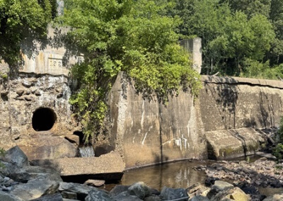
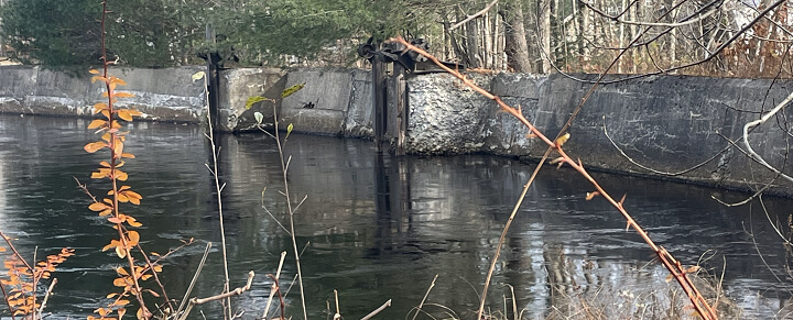
Whitney Pond Dam is an 18-foot high, earthen and concrete dam located on the Whitman River, adjacent to Rt. 101 (Center Street) in Ashburnham, MA. The image at right shows the crumbling downstream stone and masonry dam wall, and note the trees growing on the dam and shifted stones. The dam no longer provides any service to the community for industry or water supply. Since 2009, the dam has been deemed to be in Poor Condition, and the MA Office of Dam Safety (ODS) has designated it a Significant Hazard dam due to the potential risk to downstream buildings, people, and infrastructure in the event of a dam failure. Further, the dam has been found to be structurally unsound and non-compliant with MA ODS safety standards since 2017. Due to these findings, the public safety risks, and the financial burden to repair, maintain, and inspect the dam, in 2018 the Town of Ashburnham decided to remove the dam.

The dam removal process began with a feasibility study; extensive planning, design, and permitting; and studies of impact on upstream and downstream areas, sediment composition in the impoundment behind the dam, and fish and other aquatic life in the impact area. The Town has retained Pare Corporation, an engineering firm, to carry out design and permitting for the project, which are nearly complete. The Town is currently seeking funding for the removal process (aka “construction” among professionals in this field).
In 2021, the DER selected this dam’s removal and river restoration project as a “Priority Project”, meaning that the project would bring “significant ecological and community benefits to the Commonwealth.” This determination allows the Whitney Pond dam removal project to receive state funding and technical assistance from DER to conduct the removal.
Important Studies and Design Plans
- View the most recent Phase I Inspection / Evaluation Report for a detailed description of the structural integrity of the dam and an Opinion of Probable Costs of removal versus repair and maintenance. (Completed January 2018)
- Preliminary Dam Removal Feasibility Study: Whitney Pond Dam Removal for further details on existing site conditions, the initial hydrological and hydraulic analysis, a conceptual proposal for dam removal, and an updated Opinion of Probable Cost for dam removal. (Completed January 2020) Section 1. Section 2. Section 3. Section 4.
- View the February 2024 Site Plans for the proposed project. Note: These are not final site plans. Site plans cannot be finalized until all permit reviews are complete.
Permitting
Local, state, and federal permits are essential to ensure that the proposed project complies with all relevant regulations.
The following permits have been secured for this project:
- MA Office of Dam Safety Chapter 253 Dam Safety Permit (Permit #: 223-2021-387; Issued: 7/2021, Extended until 8/12/2024).
- MA 401 Water Quality Certification for Dredge and Fill (Transmittal #. x287447; Issued: 4/28/2022) and Water Quality Certification application: Section 1 Section 2 Section 3 Section 4.
- MA MEPA Certificate (EEA #16233; Issued: 4/2/2021) Access the project’s MEPA Single Environmental Impact Report here.
- Restoration Order of Conditions (under the MA Wetlands Protection Act; File #CE 092-1055; Issued: 4/24/2024)
- US Army Corps of Engineers – Section 404 (File #: 2020-1680; Issued: 9/3/2024) Access follow-up comments to the Army Corps here.
- MA Chapter 91 License and Permit (Filed: 6/28/2024; Issued 3/27/2025)
The Dam Removal Process
The removal of Whitney Pond Dam will involve:
✔ Breaching the dam
✔ Disassembling any related structures
✔ Removing contaminated soils in the dam impoundment
✔ Restoring the river, riverbank, and wetlands
✔ Monitoring fish populations, plant re-establishment, channel formation, and water quality
An example of an alteration that will take place: In the photo to the right (from Pare Corporation),the current downstream culvert indicated by red arrow that will be transformed into open channel as part of the dam removal and river restoration.
Once the dam has been removed, the dam impoundment will transition to a healthy emergent wetland, intersected by the restored Whitman River.

View “Fundamentals of Dam Removal for Dam Owners and Municipalities” (1:04:00 min.) to learn more about the technical side of the dam removal process in Massachusetts.
Benefits of Removal
Removing Whitney Pond Dam will:
- Improve public safety
- Eliminate public spending on dam inspections, maintenance, and repairs
- Greatly benefit fish, wildlife, and public health
The Whitman River, a tributary to the Nashua River, provides critical habitat for coldwater fish species. Removing the dam will reconnect 10.5 miles of upstream and downstream river habitat, letting fish move freely along the river once more. Dam removal will also improve water quality and remove polluted river sediment.

Millie Turner Dam site on the Nissitissit River in Pepperell, MA before removal and after removal. These photos provide one example of how landscapes evolve following dam removals. Photo on left from Squan-a-tissit Trout Unlimited.
Questions?
Learn more about dam removals in Massachusetts on the DER’s website: River Restoration: Dam Removals.
Contact Jessica Veysey Powell, NRWA Water Programs Director.
Project Partners



Updates to This Project
Whitney Pond Dam Removal & River Restoration Project: Ashburnham
Under a grant from the MA Division of Ecological Restoration (DER), the NRWA is helping to lead outreach and information efforts in Ashburnham in regards to the town's decision to remove the Whitney Pond Dam. The NRWA views dam removal on a case-by-case basis. Each...